Archeconsult has attented the project of UAV flights, LIDAR scanning and geodesy measuring on spectacular terrain shape (“reduta” terrain fortress) in Western Bohemia.
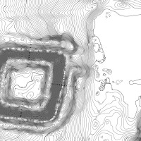
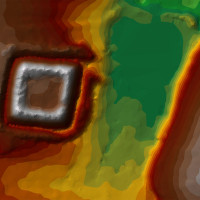
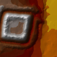
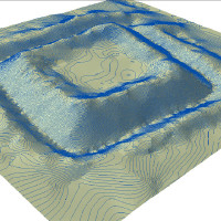
Fairly unknown rectangular terrain feature is an object of eminent interest of Czech National Heritage Institut of Western Bohemia. Archeoconsult made out the technical issues involving terrain geodesy, UAV flights and data postprocessing (modeling and visualisation). The goal was the collection of mesured grid of 0.3 x 0.3 m allowing very detailed evaluation of all surface irregularities present on site. GIS dataset achieved would serve for the further analysis and investigation.