A few airborne scans of the river systems (or is the “water meadows” term better?) in Czech Republic (Bohemia).
Just for having fun and to emphasis the need of careful hydrology reconstruction before any archaeological spatial settlement study takes place.
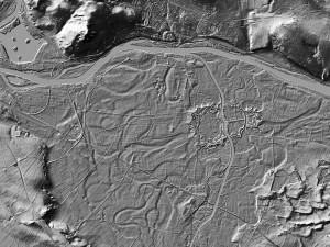
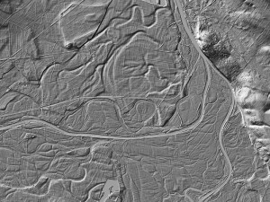
Fig. 01 – situation in the vicinity of “Porta Bohemica” near Litoměřice town. Terezín is one of most known tourist destination here. The localization of the fortress on low-lying flood area is not randomness – there was an idea to flood those area for defensive purposes.
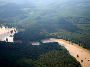
However it is obvious that any spatial examination in this region (more than 100 km2) should perform the hydrological reconstruction extremely carefully before any potential settlement study. Is there any “temporal key” for Labe/Ohře meanders in geological ot hydrological papers?Fig. 02 – a mouth of the river Vltava into Labe, near town Mělník shows quite similar spatial circumstancies. Water meadows and floodplain forrests are preserved till today making the passing through quite adventurous namely in spring.
It is worth to mention that one of the most known hydrological study of this microregion (Elleder 2007) was partially based on archaeological and historical evidence.
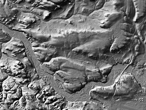
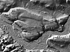
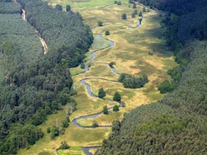
Figs. 03 – 06. And finally, Ploučnice river with its unbelievable meander system. I love this area visiting the river on boats annually. The river itself is situated in Ralsko region and its exceptionally preserver nature is the result of local isolation – no populating, agricultural changes and infrastructural development due to military and strategic landuse.
Good day.
What is the source of lidar visualisation presented here? Is Your company author of lidar dataset? Than you for your response.
Excellent work. Does archaeoconsult perform the laserscanning on its own?