We are proud to announce the release of 1.0.0. of the field database cluster.The development and progress could be followed on GitHub project page.Theclusteris a direct implementation of terrain docu standard published here.
Demo
The database is also deployed as a demo for those interested, if you want to try it out, use the following details:
user: demo@archeoconsult.org
passwd: demo123
Main features
- Online database cluster of primary field facts from archaeological research, web access or mobile application
- Comprehensive user administration (RBAC), database management (possibility to choose from multiple projects/databases), backup
- Integrated map projection system and map portal, GIS/CAD integration (access to DB using your GIS/CAD environment)
- Recording of research polygons, stratigraphic units, Harris matrix, sections, geodesy; complete management of image data (photos, photograms, sketches, drawings)
- Analytical module checking data consistency
- Reporting module enabling export of facts to PDF, SQL, MS Excel
- BSD 3-Clause License
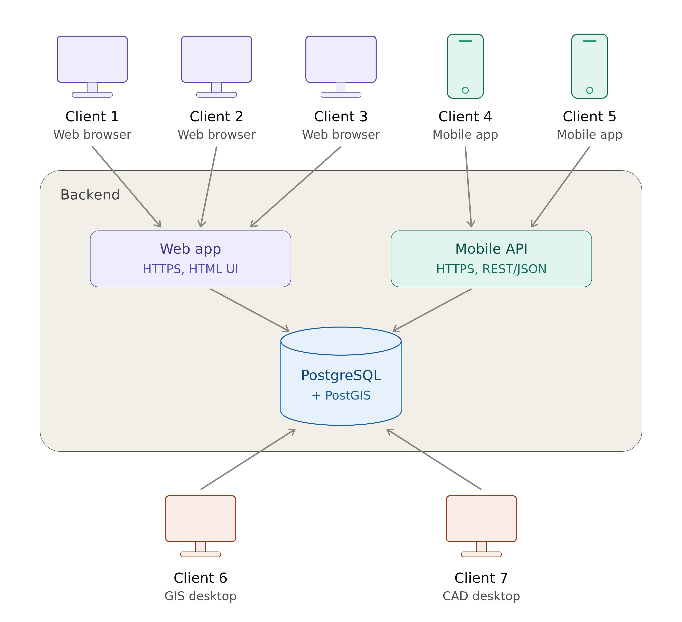
Implementation:
- PostgreSQL DB backend
- Gunicorn services for web app and mobile API
- Gradle development of Android app