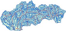
Slovakia – water sources
- Watercourses. Zipped SHP file, S-JTSK Krovak coordinate system (EPSG 5514) – Slovakia_watercourses.zip
- Water areas. Zipped SHP file, S-JTSK Krovak coordinate system (EPSG 5514) – Slovakia_water_areas.zip
Slovakia – relief and DMR
- Digital relief model of Slovakia in contours (.DWG polylines) – Slovakia_terrain_contours
Specific data sources
- Orava region, contours of 10 m height, Iron Age hillforts; S-JTSK coordinate system (EPSG 5514) – Orava_region_epsg5514 ; Orava_contours_epsg5514 ; Orava_hillforts_OSLiK_epsg5514
The assets provided by this website are licensed under Creative commons with attribution right if not stated otherwise.
![]()
