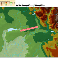
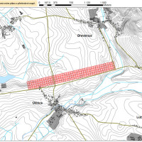
Planning R35 motorway project leads to the surface sampling and consequent spatial predictive modeling of setlement patterns in Eastern Bohemia.
The project already mentioned here is led by Labrys, o.p.s. enterprise and Archeoconsult provides the technical support and scientific analysis. Proceeding from previous experience the project goals are following:
- determining the nature of surface collection present on contemporary landscape (erosion, visibility and quantitative reduction of artefacts)
- testing the hypothesis of “non-manuring origin” of spatially distributed materialia
- definition of spatial settlement dynamics of Eastern Bohemia in general
- Oracle Spatial engine deployment and testing for analytical purposes
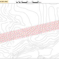
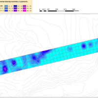
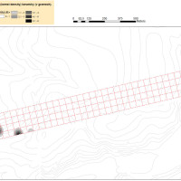
From the methodological point of view the sampling was carried out according the modern analytical guidelines (Kuna 2006) and preliminary results (“heat mapping” of kernel density/nearest neighbour algorithms used) shown in following gallery.